Real data · Copernicus
Wildfire
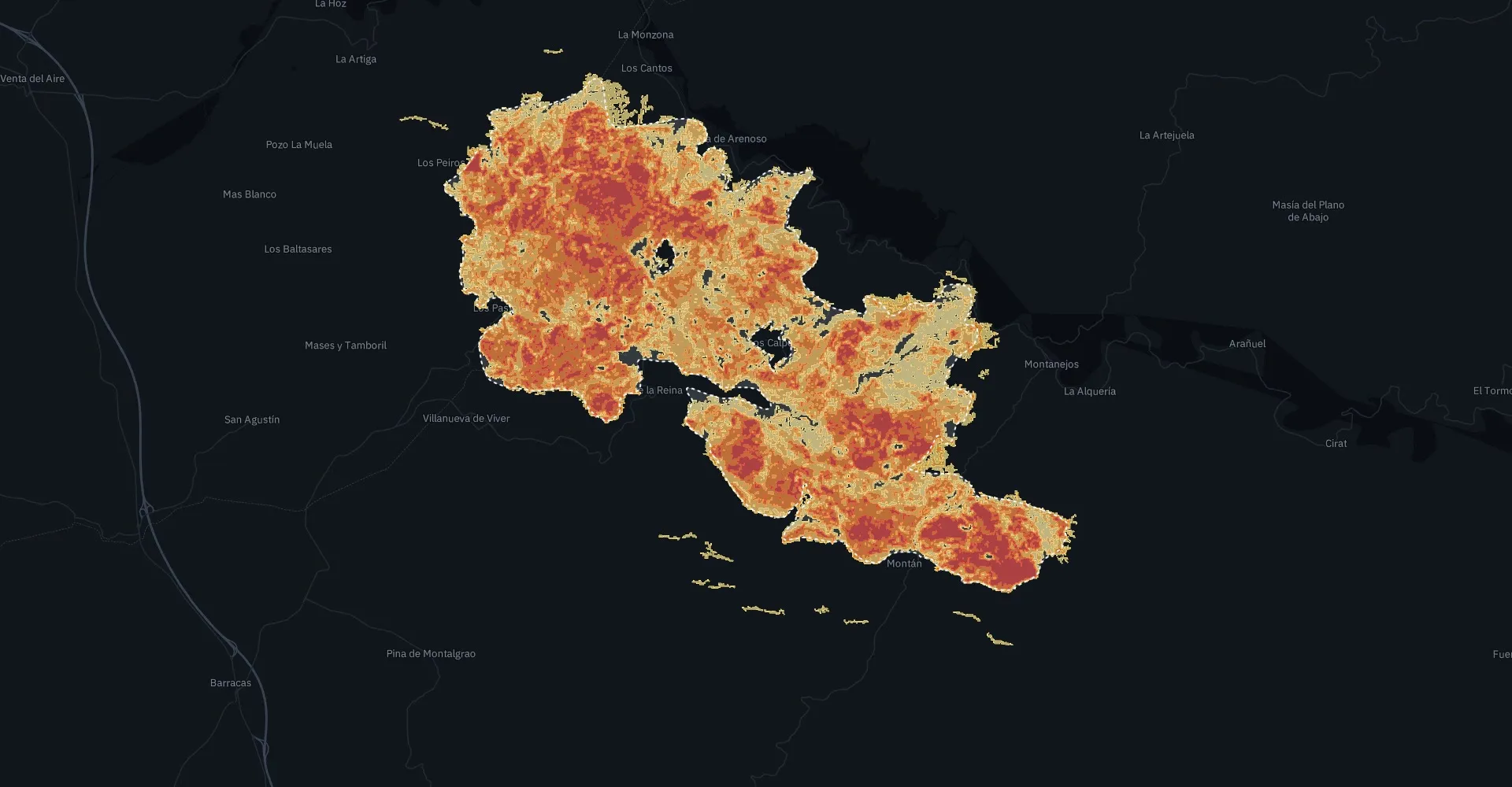
Villanueva de Viver, Castellón
March 2023 · Sentinel-2
- Aegis
- 4,576 ha
- EFFIS
- 4,604 ha
- IoU
- 0.90
Detects 94.5% of the official burned area.
Wildfires and floods · Copernicus · Galileo
Aegis watches the land from space, launches the nearest drone to confirm every alert and sends the exact position and video to the emergency centre. Then, the damage map. It works with the drones that already exist.
Satellites already detect hotspots, but they point to an area one to three kilometres wide and are often wrong. Drones already exist, but they take off when someone calls. And the damage map arrives days or weeks later.
The pieces exist. What is missing is connecting them.
The satellite points to an area, not the fire, and raises false alarms.
A drone turns that area into a coordinate and a video, if someone launches it.
Damage is measured with a map comparable to the official references.
Meteosat · NASA FIRMS · Galileo
Checks the satellites every few minutes, filters out false alarms and launches the nearest drone, from the fire service or an authorised operator. Sends the exact position and thermal video to the emergency centre.
Copernicus · Sentinel-2
Risk maps and firebreak status maps, and where drone stations should go. Tested in Morella against the regional government’s mapping.
Copernicus · Sentinel-1 and 2
Wildfire or flood damage map within days, comparable to the official European references.
We build neither drones nor satellites.
Aegis is the software that connects the satellites that already exist with the drones that already exist: the fire service’s own or any authorised operator’s.
The same method on three events, compared with the official European references. Agreement is measured as IoU (intersection over union): 1 would be a perfect overlap.
Wildfire
March 2023 · Sentinel-2
Detects 94.5% of the official burned area.
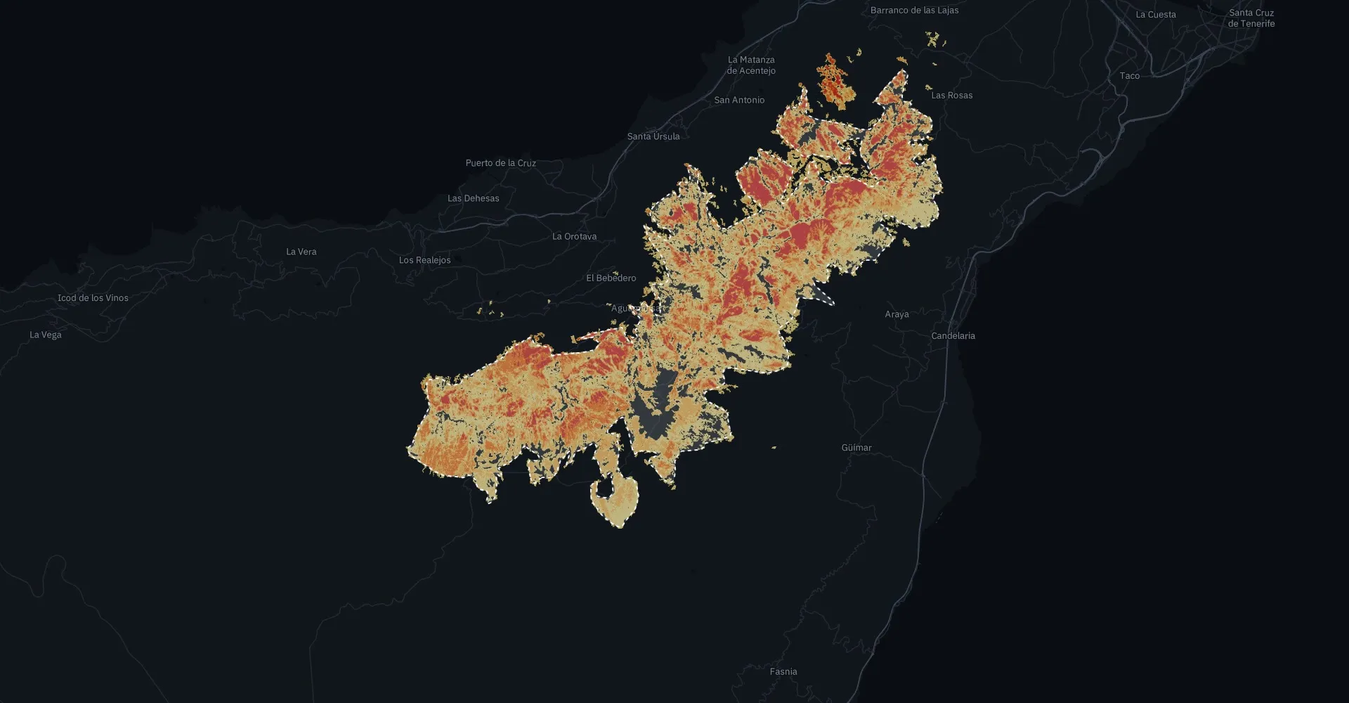
Wildfire · same method
August 2023 · Sentinel-2
No thresholds tuned for the island. Detects 86.0% of the official area.
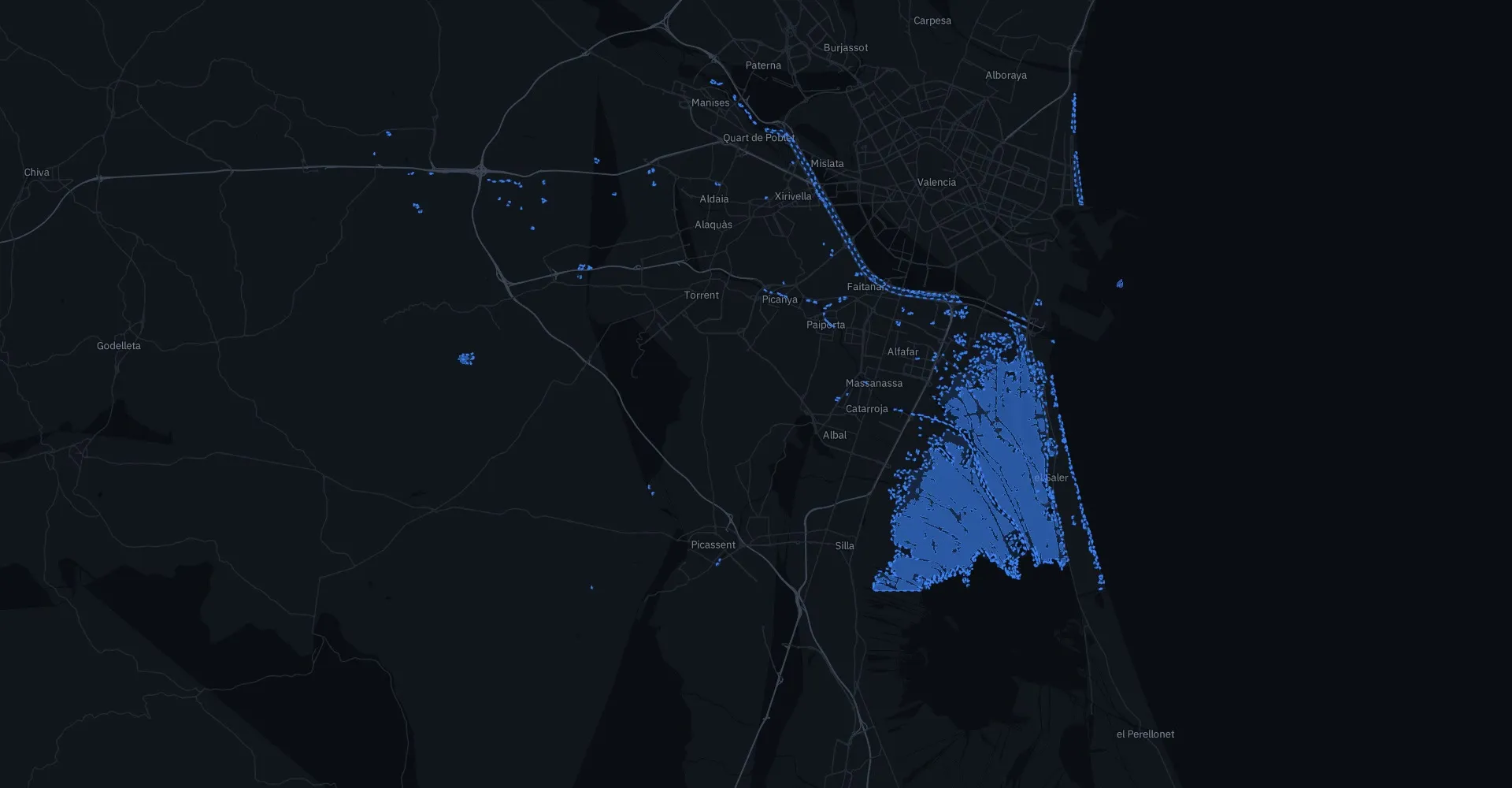
Flood
October 2024 · Sentinel-1 radar
98.7% of what Aegis flags as water is water. Radar underestimates water in built-up areas; combining radar and optical data is on the roadmap.
Reference areas: as published by EFFIS and Copernicus EMS; IoU is computed on the polygons, in EPSG:25830 (Tenerife: EPSG:4083). References: EFFIS (JRC, European Commission), perimeters 214574 and 218653; Copernicus EMS, activation EMSR773. Images: screenshots of the Aegis viewer. Full, reproducible methodology available on request.
Where no drone is nearby, automated stations run by an already authorised operator and placed according to Aegis risk maps.
Fixed station
Automated dock with one drone
For permanently exposed areas. The drone takes off when an Aegis alert arrives, returns, recharges and waits for the next one. In the demo simulation, each station covers a 8 km radius.
Concept drawing. Not a manufactured product.
Mobile station
Container with several drones
Solar power and its own communications. Trucked to wherever the risk maps point each season, or sent as back-up during a large fire.
Concept drawing. Not a manufactured product.
Model
If the emergency service already has drones and pilots, Aegis triggers them with its alerts and turns what they see into maps. Where there are none, stations are run by an operator already authorised by AESA, the Spanish aviation authority. We neither buy drones nor apply for flight permits: we provide the data and the software.
Aegis Prevention and Aegis Damage for municipalities and consultancies: the part already validated with real data.
Aegis Alert pilot with a provincial council or a fire service: the satellite alert launches a real drone.
Aegis Alert for regional governments, emergency centres and insurers.
Do you manage land exposed to wildfires or floods: a municipality, a provincial council, an emergency service or an insurer? We will walk you through the demo with real data.